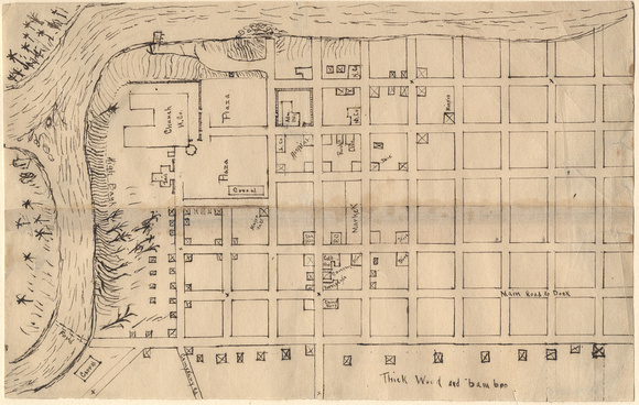
Map of city at confluence of two rivers, circa 1850 (1979-1094)
Hand-drawn map of an undesignated city at the confluence of two rivers. The community is located along a river, with an American grid plan, Spanish plaza, docs, stores (including Chinese), and military buildings.